EAST TENNESSEE GEOLOGICAL SOCIETY
| Geologic Excursion Across Part of the Southern Appalachian Foreland Fold-Thrust Belt in Northeastern Tennessee - 2005 Fall Field Trip |
| Hawkins and Greene Counties, Tennessee |
| Saturday, December 3, 2005 |
| Trip Leaders: Peter J. Lemiszki & Martin S. Kohl Tennessee Division of Geology |
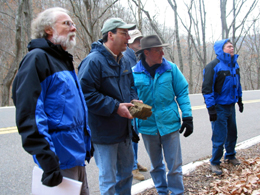
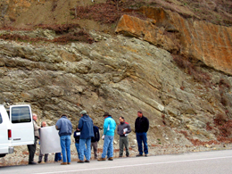
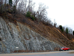
Beginning the day at an exposure of the Copper Creek Fault,
ETGS members orient themselves to the region's structural
geology.
Photos by George Yu and Jim Morgan.
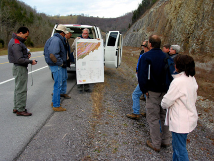
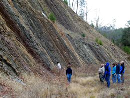
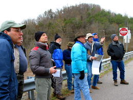
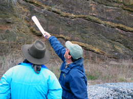
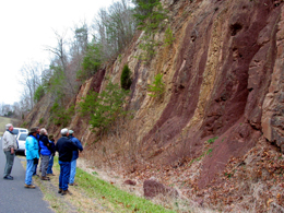
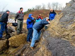
Stop 1: ETGS members gather to hear a discussion of the proposed emplacement history of the Copper Creek fault. |
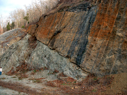 Stop 1: Exposure of the Copper Creek thrust fault at War Ridge. Lower Cambrian Rome formation(dark colored rock on right) in the hanging wall and Middle Ordovician Moccasin Limestone (light colored rock on left) in the footwall. |
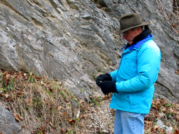
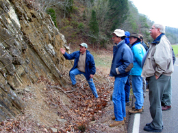
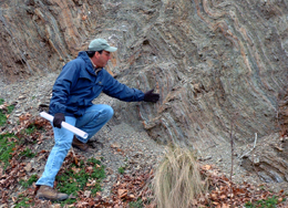 Stop 2: Pete Lemiszki discusses the fold styles developed in the Rome Formation. |
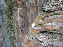
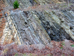 Stop 2: Southeast dipping bedding of the Rome Formation. |
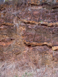
 Stop 2: Field trip participants are mesmerized by the variegated colors typical of the Rome Formation. |
 Stop 2: Fold in the Rome Formation. |
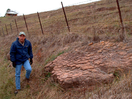 Stop 3: Mud cracks in the Middle Ordovician Chickamauga Group &ndash Luther Formation red mudstone. |
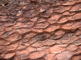 Stop 3: A closer examination of the desiccation polygons indicates that they have been deformed by a layer-parallel shortening strain. |
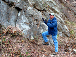
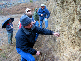
Stop 4: ETGS President (2004-2005) Mark Gardiner examines gray limestone from the Middle Ordovician Moccasin Formation. |
Stop 4: Martin Kohl (left) points out the location of a mesoscopic duplex in the Middle Ordovician Moccasin Formation. |
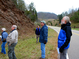
 Stop 5: The blue-man coat crew examines folds in the Martinsburg Formation. |
 Stop 4: Pete Lemiszki describes his interpretation of the duplex structure. |
 Stop 4: Pete Lemiszki points to a cross-section and describes the regional structural setting of the next few stops. |
 Stop 5: Pete Lemiszki describes the geometry of northeast and northwest verging folds in the Martinsburg Formation. |
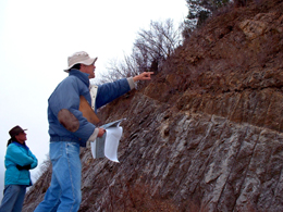
Stop 9: Martin Kohl points to the Town Knobs fault, which places Lower Cambrian Rome Formation in the hanging wall on Middle Cambrian Maryville Limestone in the footwall. |
Stop 9: Town Knobs thrust fault. |
Stop 9: Martin Kohl describes his interpretation of the structures that developed along the Town Knobs thrust fault. |
Stop 9: Town Knobs fault exposure. |
Stop 9: Normal faults in the Rome Formation. |
Stop 9: Pete Lemiszki points to thrust and normal faults responsible for duplicating and then offsetting beds in the Rome Formation in the hanging wall of the Town Knobs fault. The yellow-tan beds are actually the same bed repeated by faulting. |
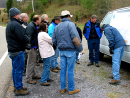
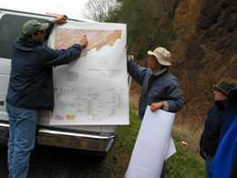
Stop 10: Pete and Martin point out the location of the Bays Mountain Synclinorium on the state geologic map. |
Stop 9: Pete Lemiszki describes his interpretation of the faulting sequence within the Rome Formation in the hanging wall of the Town Knobs fault. |
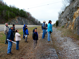
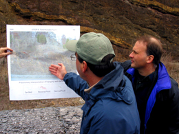
Stop 10: Field trip participants assemble to hear the next exciting tidbit of information about the Middle Ordovician Bays Formation. |
Stop 10: Field trip participants examine the interbedded maroon mudstones and tan sandstones in the Bays Formation. |
Stop 10: Keri Brill samples a possible thin K-bentonite bed in the Bays Formation. |
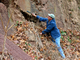
Stop 10: Pete Lemiszki points to faint plumose marks that form on an extensional fracture surface. |
Stop 11: Pete Lemiszki discusses veining and fracture development in the Martinsburg Formation. |
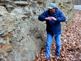
Stop 13: Pete Lemiszki points out the pervasive cleavage in the Sevier Shale. Bedding dips moderately to the right and cleavage dips moderately to the left and forms the surface of the outcrop in the photo. |
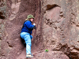
Stop 13: Looking for vugs with quartz crystals in the Sevier Shale. |
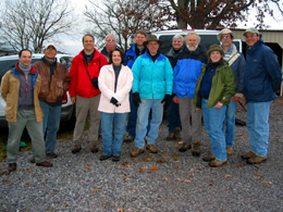
Stop 14: ETGS field trip participants pose for a group photo at the last stop of the day where they collected quartz crystals in regolith overlying the Knox Group. |
ETGS thanks Shaw Environmental & Infrastructure, Inc. for sponsoring the reproduction of the guidebook for this field trip!
|
Page updated
May 19, 2018 |