EAST TENNESSEE GEOLOGICAL SOCIETY
| Rock and Roll: Geology By Bicycle - 2000 Summer Field Trip |
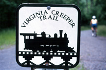
| Stratigraphy along the Virginia Creeper Trail between Whitetop Station and Damascus |
| Mount Rogers National Recreation Area, Virginia |
| Saturday, June 3, 2000 |
| Trip Leader: Tony Tingle |
Photos by Brad Stephenson, except where otherwise noted.
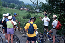
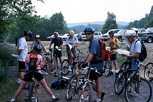
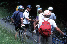
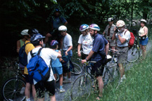
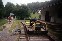
Geology Orientation at Whitetop Station
|
|
|
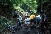
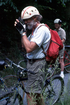
| Seventeen
eager cyclists (including four "junior
geologists") gather at Whitetop Station for an
introduction to the local geology by Tony Tingle. Whitetop is the topographic highpoint of the
trip; |
|
|

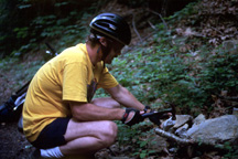
Stop 1: Mount Rogers Formation
|
|
The sedimetary and volcanogenic rocks* of the Late Proterozoic Mount Rogers Formation (Rankin, 1993) are thought to have been deposited in basins created by rifting prior to the opening of the Iapetus Ocean [(Rankin, 1975; Wehr and Glover, 1985; Schwab, 1981, 1986) as cited in Miller, 1994]. They are interpreted to have been deposited atop 1.2 to 1.0 Ga crystalline rocks of the Grenville province of Laurentia, and to have been thrust (with the underlying crystalline basement) over rocks as young as Mississippian in age (Rankin, 1993). *Although sedimentary and volcanic in origin, these rocks have been metamorphosed to greenschist facies. |
|
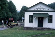
Stop 2: Green Cove and Cat Face Fault
|
 |
|
 |
 |
 |
|
 Photo by Donna Russell |
 Photo by Donna Russell |
|
||
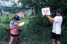
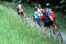
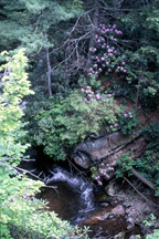
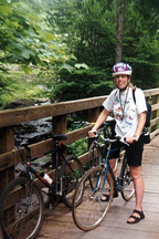
Mountain Streams
| Modern
wooden bridges have replaced the tressles of yesteryear,
providing beautiful views of the mountain streams cutting
their way downward. The junior geologists on the trip had their own ideas about what to do with the rocks! |
|
|
ADDITIONAL INFORMATION
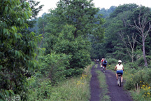
ETGS organized a stratigraphic bicycle tour on the Virginia Creeper Trail on Saturday, June 3, 2000. The Virginia Creeper starts in Abingdon and ends at Whitetop Station--a total length of 33.4 miles. It began as a Native American footpath and became part of the Virginia-Carolina Railroad system in 1907. Now it serves as a multi-use recreation trail.
A shuttle service (Blue Blaze Bike and Shuttle Service) transported us to the top of the trail at Whitetop Station, and we rode back down 17 miles to Damascus. Blue Blaze is located in Damascus, Virginia, about 3 hours from Knoxville, Tennessee.
ACKNOWLEDGEMENTS
Tony Tingle was the trip leader for this outing. He developed the geology trail log and scouted the trail and outcrops in advance. ETGS thanks Tony for a job well done! Please contact Tony if you have any questions regarding the geology of the trip area.
Carla Sparks assisted Tony with scouting the trip route and preparing the trail log. ETGS thanks Carla, as well!
Seaira Stephenson coordinated the logistical aspects of the trip, including registrations and arrangements with the outfitter. Thanks to Seaira for making it happen!
|
Page updated
May 19, 2018 |