EAST TENNESSEE GEOLOGICAL SOCIETY
| Traverse from the Upper Crust to the Lower Middle Crust of the Taconian Orogen (470-440Ma) |
| Southern Appalachians |
| Saturday, December 7, 2024 |
| Trip Leader: Dr. Robert D. Hatcher Jr. |
Field Trip Guide Book /
Google Earth KMZ File
Click the links below to see photographs at each of the field trip stops.
| Stop 1-1 | Ocoee Dam No.1 (Parksville Reservoir) (35.0964 N, -84.6478 W) |
| Stop 1-2 | Cleavage and Primary Sedimentary Structures
in Wilhite Formation (Walden Creek Group) at Madden Branch (35.1096 N, -84.5590 W) |
| Stop 1-3 | Wehutty Formation at Boyd Gap (35.0432 N, -84.4502 W) |
| Stop 1-4 | Copperhill Formation in historic Ducktown,
Tennessee (35.0333 N, -84.3810 W) |
| Stop 1-5 | Mineral Bluff Formation along U.S. 64 in
Murphy, North Carolina (35.078503 N, -84.040160 W) |
| Stop 1-6 | Staurolite-Bearing Mineral Bluff Formation
South of Marble, North Carolina (35.1683 N, -83.9213 W) |
| Stop 1-7 | Migmatitic Metagraywacke (Great Smoky
Group) East of Hayesville, North Carolina (35.0406 N, -83.7947 W) |
| Stop 1-9A | Chunky Gal Mountain (35.0588 N, -83.6203 W) |
| Stop 1-10 | Metadunite of the Buck Creek Complex along
Buck Creek (35.07850 N, -84.62805 W) |
| Stop 1-11 | Winding Stair Gap (35.1224 N, -83.5435 W) |
All photos by Bob
Gelinas unless otherwise specified.
Click on photos to enlarge and use
your browser back button to return to the photo table.
|
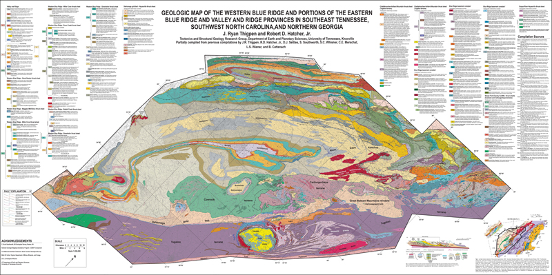
The morning start of the field trip was quite chilly (21 deg F), but clear and dry. A PDF of the large geologic map that was used for reference during the day is provided here: Geologic Map of the Western Blue Ridge and Portions of the Eastern Blue Ridge and Valley and Ridge Provinces in Southeast Tennessee, Southwest North Carolina, and Northern Georgia (Thigpen and Hatcher). Many thanks to Dr. Hatcher for permission to post the field trip guide book and accompanying geologic map. |
|
| Back to top of page | |
|
Page updated
December 10, 2024 |
